

Geotarget with free Redistricting Data Hubs maps
Geotarget canvassing campaigns with data rich maps for better results.
Redistricting Data Hub is a wonderful, free resource for non-partisan maps and data that can be used with any mapping app. It includes:
- Precinct Boundary and Election Results
- Voter Files
- Incumbent Addresses
- Population Projections
- PL 94-171
- Legislative Boundaries
- American Community Survey (ACS)
- Citizen Voting Age Population (CVAP)
- TIGER Boundary Files
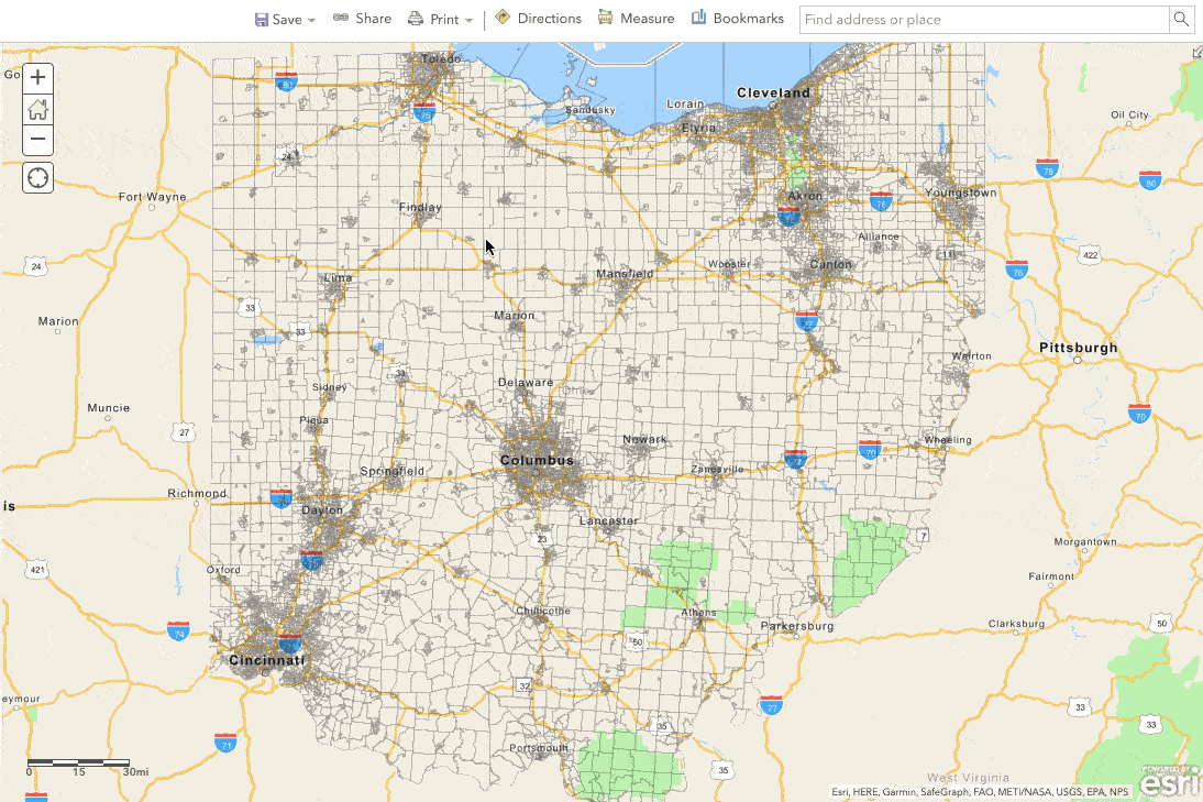
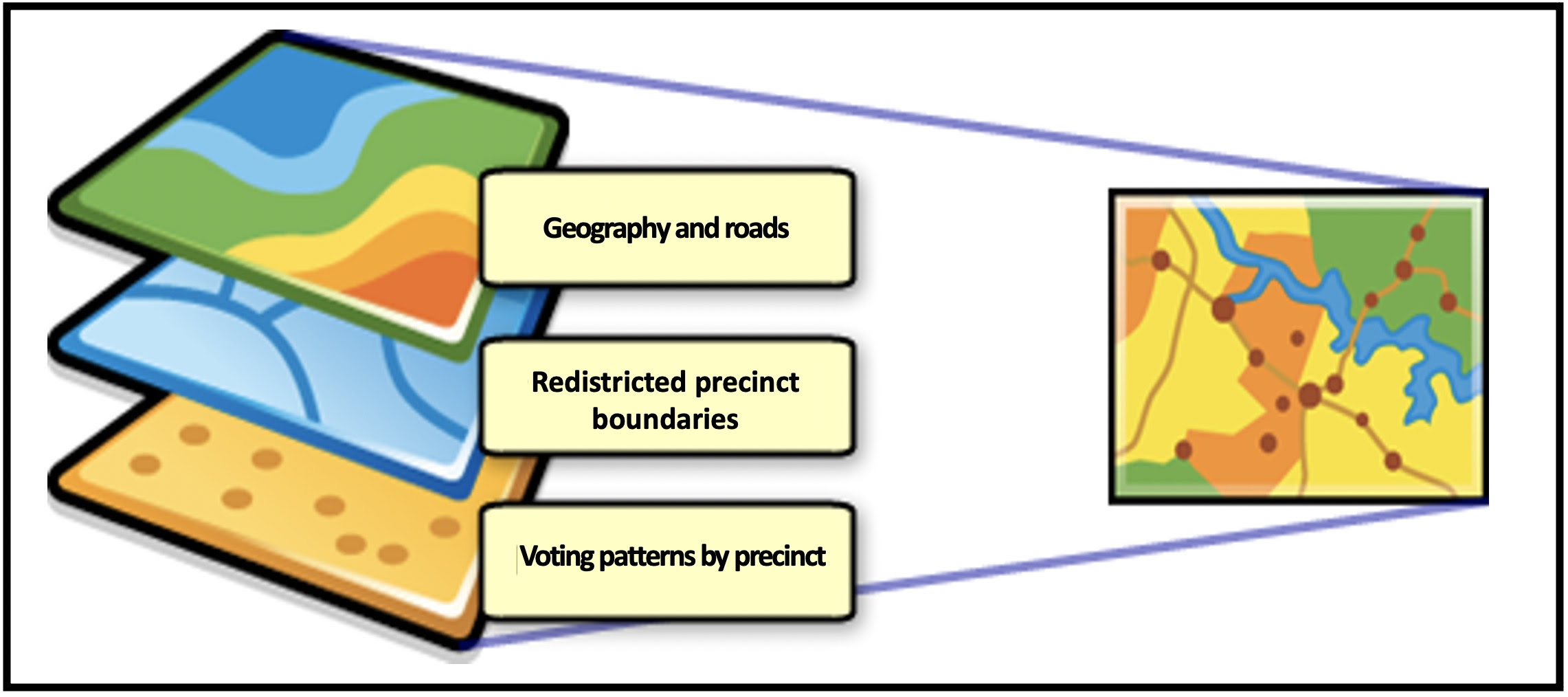
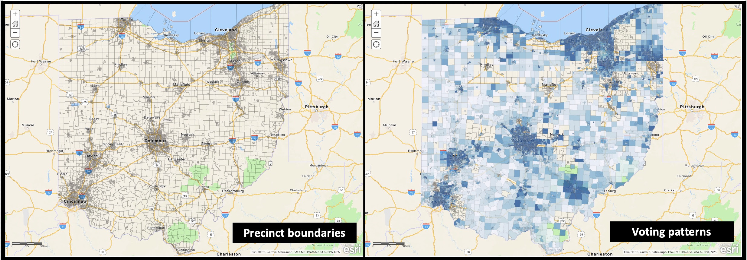
This example shows how a grassroots applied this information with ArcGIS Online to map redistricted precinct boundaries and analyzed the number of canvassers needed per precinct.
Geo-targeted canvassing campaigns
Designing a data-rich map
- Show data in layers which can be shown or hidden as needed.
- Reveal details, such as the name of a precinct as users zoom in.
- Enable ‘Search’ so that users can quickly find information.
- Attribute the source of information being used such as Redistricting Data Hub in this map
- Learn more mapping terms and classification codes such as:
- American Indian Areas
- Congressional Districts
- County and County Equivalents
- County Subdivision
- Place
- School District Code
- State and State Equivalents
- Voting District
Redistricting Data Hub
“The nonpartisan Redistricting Data Hub (RDH) was founded by experts with backgrounds in pioneering redistricting legal cases, the establishment of independent redistricting commissions, and related ballot initiatives in Florida, Arizona and other states. It is a project of the Fair Representation in Redistricting Initiative, a project of New Venture Fund (NVF). RDH believes an effective democracy requires fair representation. Its goal is to provide individuals, civic organizations, and good government groups the data, tools, and knowledge to participate effectively in redistricting processes by learning how to define their communities, provide meaningful public input, recognize gerrymandering, and advocate for fair and legal maps.“
Data available
- Precinct Boundary and Election Results – Precinct level election results merged with precinct boundaries are collected and peer reviewed with Partner Data Validation effort.
- Voter Files – 2021 Voter File data aggregated to 2010 census blocks are available for all states. This data was purchased by the Redistricting Data Hub from L2, a national voter file vendor. All states now reflect voter file data updated after 2020 general election data.
- Population Projections – HaystaqDNA produced 2020 – 2030 population projections aggregated to the 2010 and 2020 census block and block group.
- PL 94-171 – This dataset is the Redistricting Data File created by the U.S. Census Bureau for use by the states in redistricting based on the decennial census.
- Legislative Boundaries – Legislative boundary files for 2011 to the present are re-hosted from All About Redistricting for each state.
- American Community Survey (ACS) – Select fields from the American Community Survey 5-year estimates are available for 2010 to 2019 at the block group, census tract, county, and state level geographies.
- Citizen Voting Age Population (CVAP) – CVAP Special Tabulation data available for 2010-2019 at the block, block group, census tract, county, and state level. This data contains estimates by race (for Non-Hispanic/Latino) for total population, voting age population, citizen voting age population, and citizen population.
Website Access and Use
“Redistricting Data Hub hereby grants you permission to use the Website as set forth in these Terms and Conditions of Use, provided that you use the Website and any data you obtain from the Website solely for noncommercial use, not for any resale, not for any illegal or nefarious purposes, and in a nonpartisan manner which will not involve any gerrymandering. “Gerrymandering” means drawing a community of interest map, legislative district or districting plan to favor or disfavor an incumbent, candidate, donor or political party, or drawing a community of interest map, legislative district or districting plan to deny racial or language minorities the equal opportunity to participate in the political process and elect representatives of their choice.” – Terms & Conditions
TakeAway: Geotarget with data-rich maps for better results.
Deepak
DemLabs
Image credit: Coca Cola
Read in browser »
Reposted from Democracy Labs with permission.


