


Geotarget better with maps and data. Stop guessing.
Smart maps combine maps and data. They take the guesswork out of choosing the best areas to target.
Businesses pick the best locations for their stores using data-rich maps. Savvy community organizers and campaigns use the same tools to pick the areas to focus on. It’s fast, easy and affordable.
VOTE OUT POVERTY designs solutions that meet the needs of the community they serve. They start by listening with compassion and empathy. This blog describes how they chose an area to canvass to understand the needs of the community in Hattiesburg, Mississippi.
Using maps and data to target where to focus

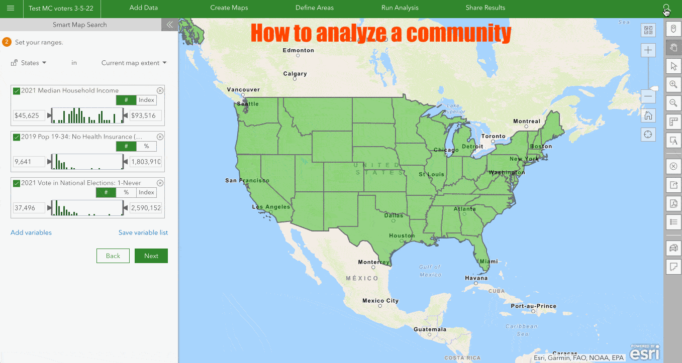

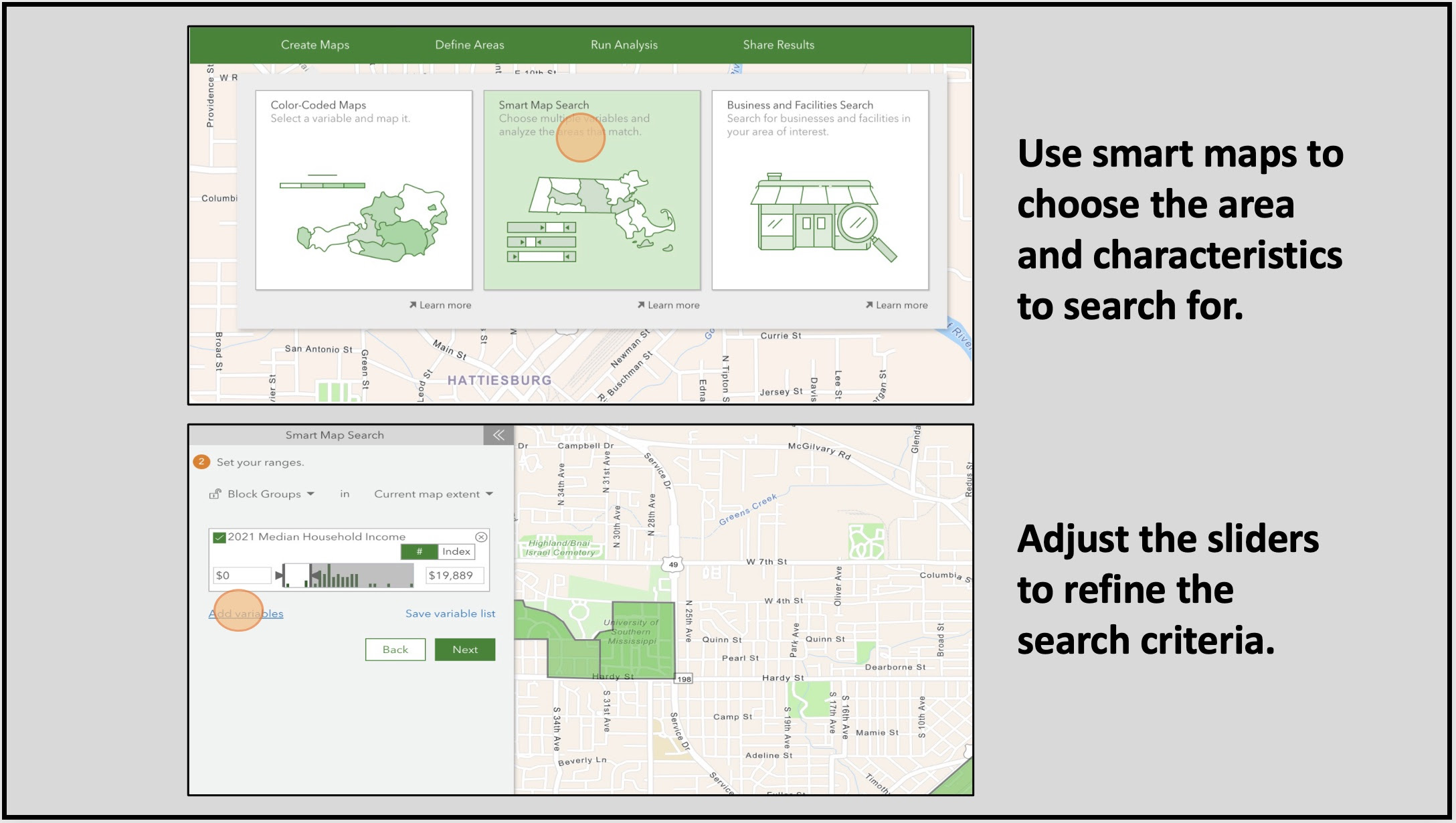

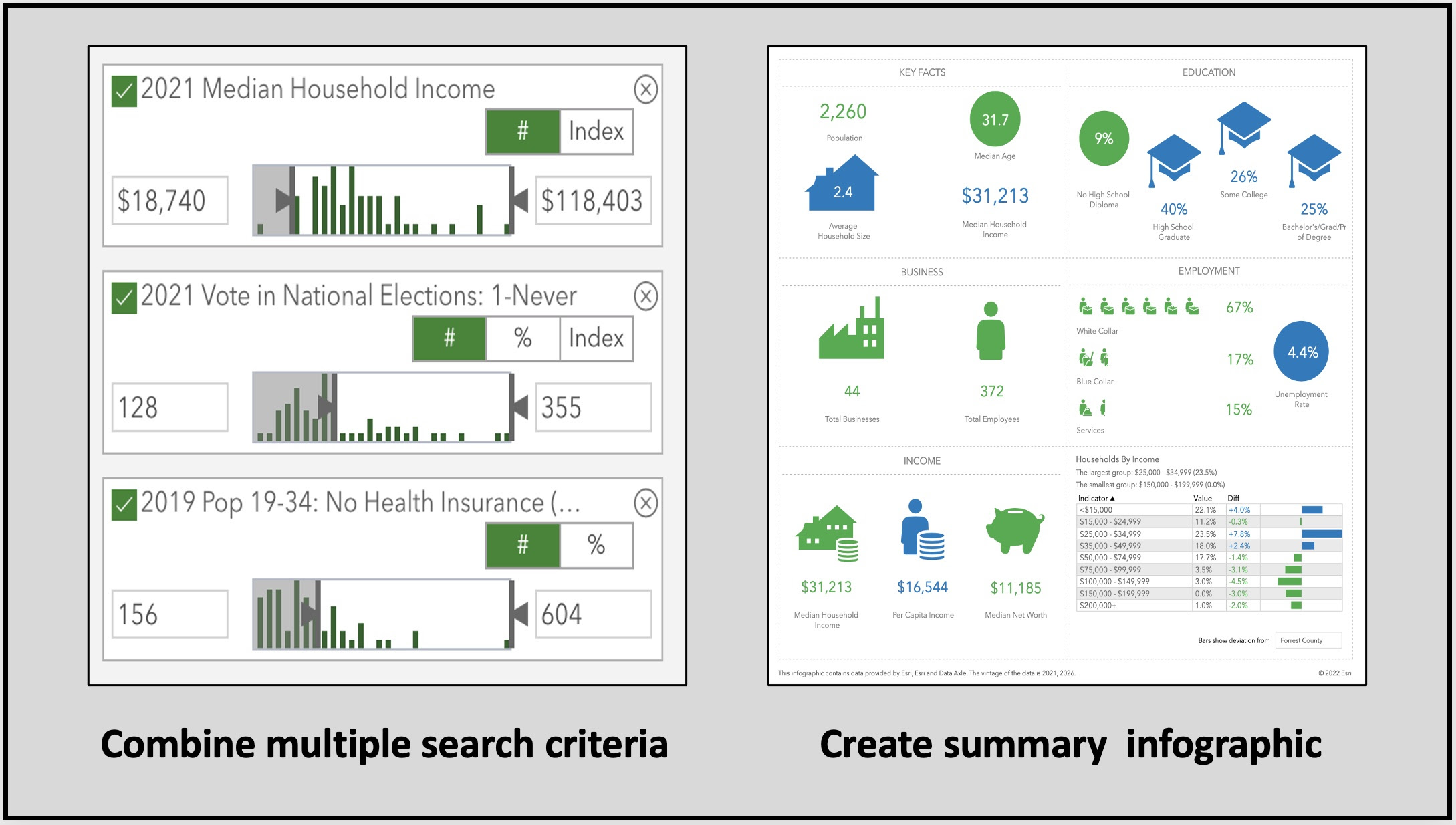
Step-by-step guide to analyzing a community
Seek out underserved communities
“Corporate donations aimed at supporting anti-racism causes surged in 2020. But another way businesses can do their part to combat systemic problems is to proactively set out to reverse them. Areas traditionally underserved by banks and full-service grocery stores — financial and food deserts that trace their lack of services to historic redlining — can be ripe for an ethical, entrepreneurial enterprise.
It takes smart maps to understand an area’s residents and what they need, like building up a record of credit or better transportation networks to access grocery stores and banks. In the case of banking deserts, financial institutions can use location-intelligence tools to visualize where inequities exist. It isn’t charity… Socially conscious businesses can pinpoint communities that may be lacking vital resources by layering social-equity data on maps showing what is (or rather, isn’t) available, like sidewalks.” – Entrepreneur
Data powered maps
Data powered maps capture the socioeconomic conditions of an area. Smart maps provide location intelligence that companies like FedEx and BP use for:
- Better investments and executive decisions
- Improved sustainability and equity
- New levels of efficiency and business resilience
- Data-driven customer responsiveness
- Increased collaboration and communication
Vote Out Poverty
The VoteOutPoverty USA Group provides pathways to help meet the basic needs of a community. They work to bridge people, ideas, and resources to enhance the community and improve outcomes. This blog describes how The Vote Out Poverty USA Group would choose an area in Hattiesburg, Mississippi for canvassing to better understand community needs.
TakeAway: Use maps and data to take the guesswork out of choosing where to focus.
Deepak
Democracy Labs
Image credit: HDwallpapers
Read in browser »
Reposted from Democracy Labs with permission.