


Activists fight with limited resources against well funded political incumbents. They have to pick their targets strategically. Good mapping software can be the equalizer.
Which incumbents are vulnerable? Which districts are most flippable? Where are local volunteers concentrated? Where are local partners based? How should the campaign prioritize targets?
A strategic plan has to factor for many variables. Mapping software enables better decision making by presenting information clearly. Activist groups are innovating with geographical information systems (GIS) to plan their strategies to topple incumbents.
Background
“I think one of the most important aspects of this valuable ‘power map’ is that local groups have the information on how to best use their energy and talents. Local groups choose where they think they can make the greatest impact. No one is telling them what to do.
The map gives power to activists. They know what is achievable by looking at the landscape, assessing their capabilities, and deciding for themselves what is possible . Group leaders know exactly where to show up, where to build relationships, and how to take action. People want to be a part of something bigger than themselves. When they see themselves in the vision, they act”, explained Michelle Pallas the Co-Founder of StateWide Indivisible Michigan (SWIM).


Smart Maps
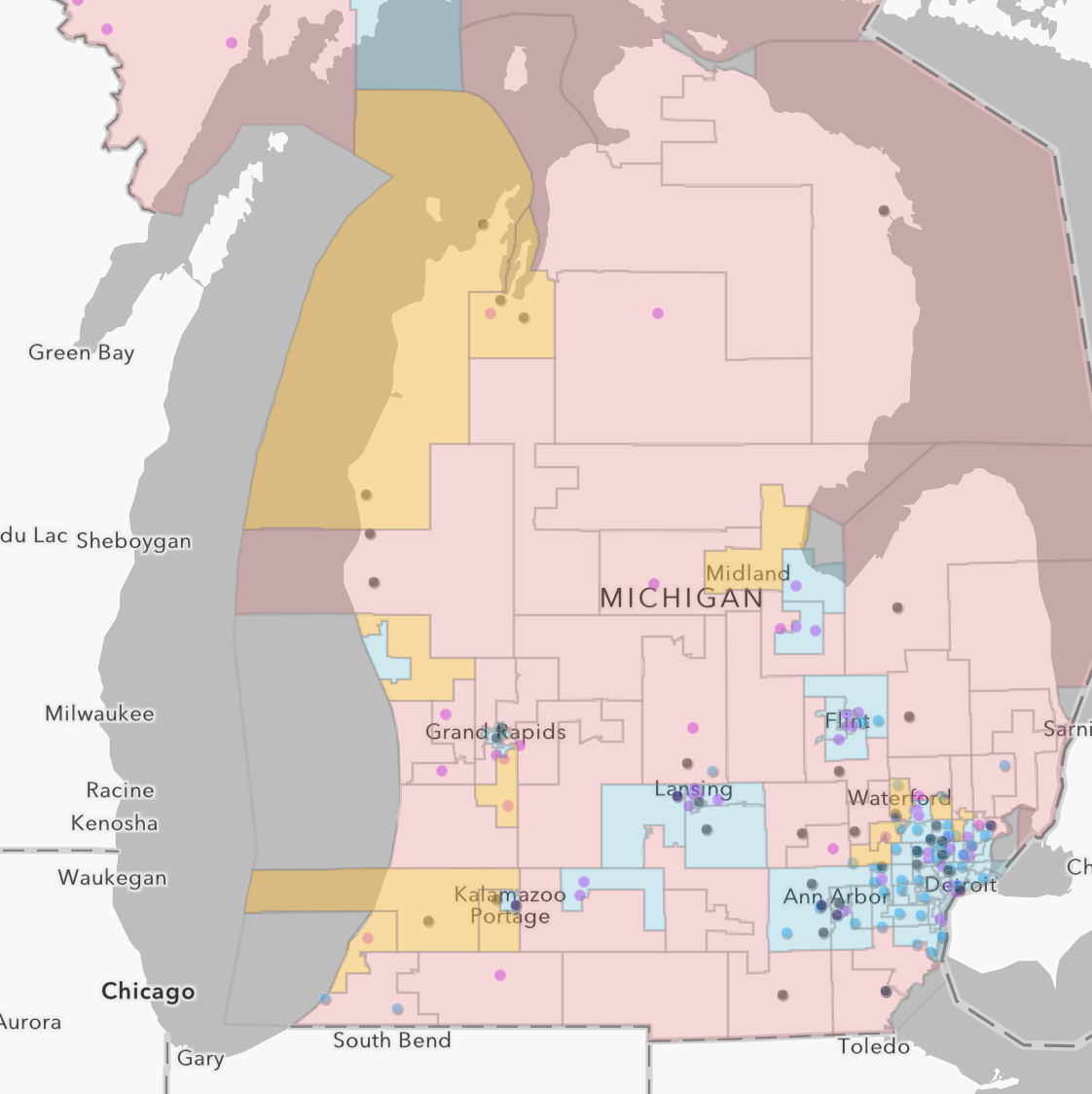
A smart map consists of layers of information which can be viewed either individually or together. The SWIM map has layers that for geographies, state districts, congressional districts, Indivisible chapters, Democratic clubs and Union Halls. Activists can turn layers on and off with the selection box on the right. Together these layers, provide spatial insights that are hard to recognize when seen individually. Individual cities and districts can be located with the search bar at the top.


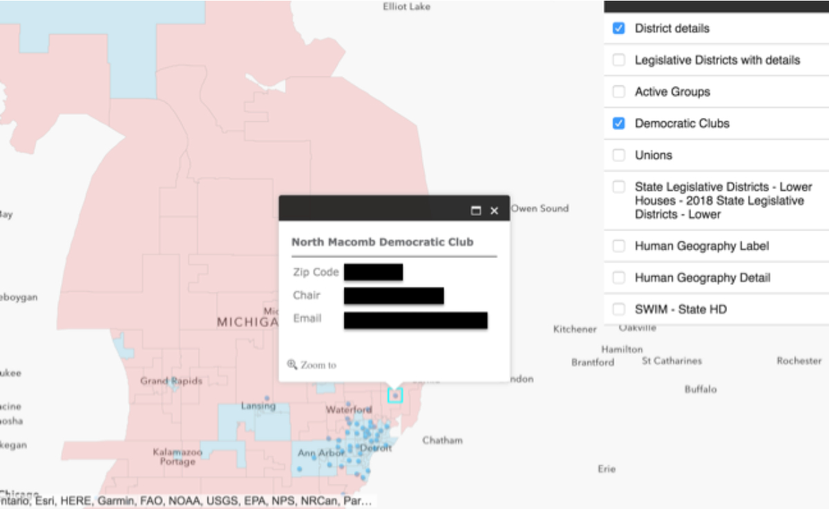


Details on unemployment, income, education, age and ethnic communities are added from Statistical Atlas (a free app). This helps activists identify districts to target and find nearby partner groups to help.


What makes for a good map?
- Simplifies decision making.
- Shows data at the level needed and hides details unless needed. This map has further details on elected officials, party affiliations, challengers and contact details for local chapters.
- Makes it possible to look at the map from different perspectives by selectively adding and removing data layers on the map.
- Can be shared securely
- Multiple team members can use the map at the same time.
- It’s easy to update with new information.
- Has a simple user interface so volunteers can use it without training.
- The software has to be affordable!
Takeaway
Small activists group fight an asymmetrical battle against well funded opponent. They have to plan strategically and pick targets carefully. Smart mapping software like ArcGIS and Statistical Atlas level the playing field. Learn how to better map your campaign battlefield here.
Deepak
Co-Founder, DemLabs
Please share this bulletin. DemLabs is a SF-based, progressive hub for ongoing technology and creative innovation. We focus on free and affordable apps. Donate here to support our work.